Brighton Beach And Seafront: What To Do Along The Front
First thing to know: Brighton beach is pebbles, not sand. Once you accept that, the seafront becomes one of the best free strolls on the south coast. Here is how to walk it.
 Written with Oliver Bennett, Brighton bus tour guide & local sightseeing specialist
Short answer
Brighton beach is a shingle, or pebble, beach, not sand, running the length of the seafront from the i360 tower in the west to Brighton Marina in the east. The strip below the road is lined with bars, cafes, galleries and the pier, and both Volk's Electric Railway and the open-top bus trace it, so you can walk one way and ride back.
Let me save you a disappointment before you pack a bucket and spade. Brighton beach is not sand. It is shingle, smooth grey and white pebbles that crunch under your shoes and dig gently into your back when you lie on them. Regulars bring a foam mat and stop noticing. Once that is settled, the seafront reveals itself as the real draw: a couple of miles of promenade, bars tucked into brick arches, galleries, the pier, and views that go from a Victorian ruin to a 138-metre tower. Here is how to take it in.
The pebble beach and promenade are free; paying makes sense only when you want a wider coastal view, an indoor attraction or a guided way to cover more ground.
Booking Choice: Brighton beach is a shingle, or pebble, beach, not sand, running the length of the seafront from the i360 tower in the west to Brighton Marina in the east. The strip below the road is lined with bars, cafes, galleries and the pier, and both Volk's Electric Railway and the open-top bus trace it, so you can walk one way and ride back. Explore Brighton Coastal Bike Tour
Is Brighton Beach Sand Or Pebbles?
Brighton beach is a shingle beach, made of pebbles rather than sand, along its entire length. The stones get larger near the water and smaller up by the promenade. Sand appears only at very low tide in patches, and never enough to build on. Bring something to sit on, and water shoes if you plan to swim, because the pebbles are hard on bare feet.
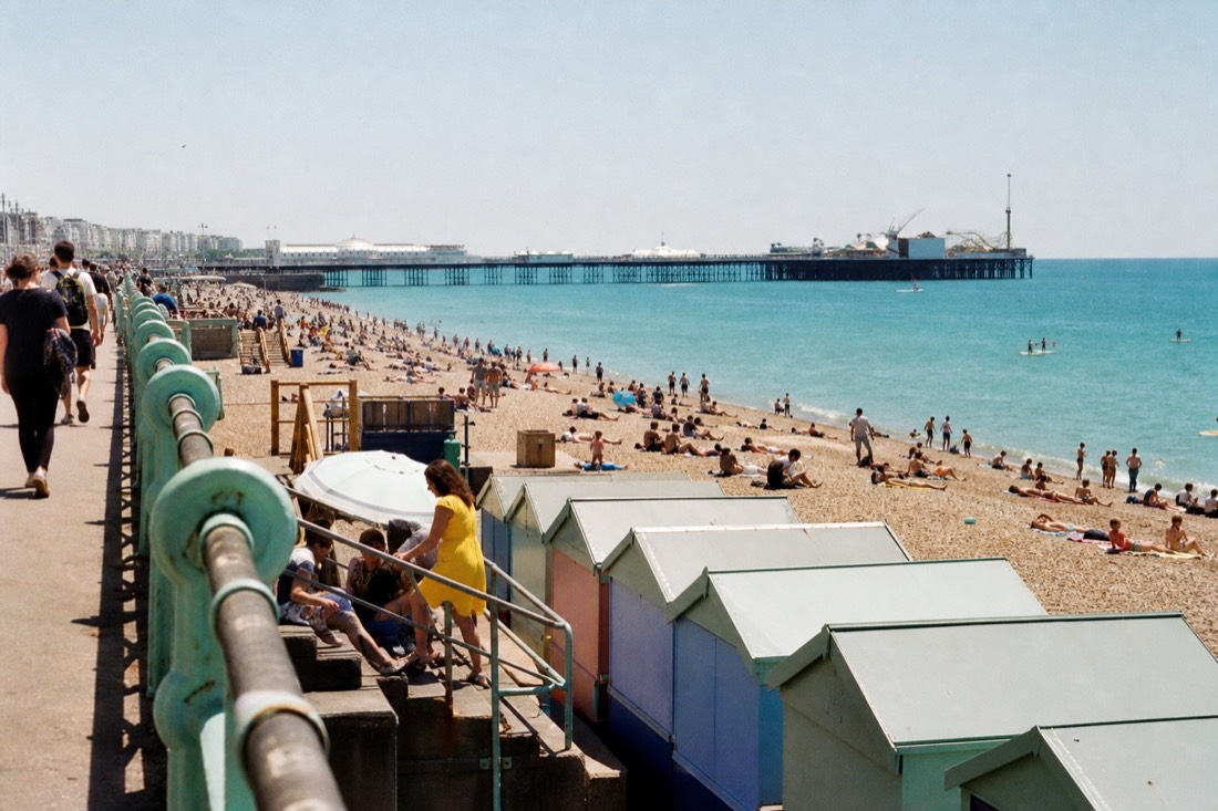
This is the single most common surprise for first-time visitors, so it is worth stating plainly. There is no sandy beach in central Brighton. What you get instead is a wide, sloping bank of clean pebbles that stays usable even after rain, drains fast, and gives the seafront its particular sound and texture. Swimming is popular in summer, the water shelves quickly, and there are lifeguarded zones in season. If sand is non-negotiable for the kids, the beaches further east and west of the city vary, but the central strip is pebbles from end to end. Brighton's official visitor site lists the seafront facilities, lifeguard seasons and accessibility points.
What Is There To Do Along Brighton Seafront?
The seafront strip packs in the Palace Pier, the arches full of bars, cafes and galleries, the ruined West Pier and the i360 tower to the west, and Brighton Marina to the east. You can swim, play beach volleyball, hire a deckchair, eat fish and chips, browse artists' studios in the arches, or just walk the promenade. Most of it costs nothing.
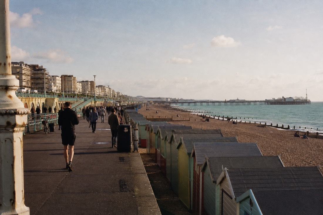
The lower promenade, down at beach level below the main road, is where the character lives. Victorian brick arches have been turned into seafood bars, coffee shacks, artist studios and small music venues, and the stretch between the piers hums on a warm evening. Above, the upper promenade is the wide pavement that the traffic and the open-top bus run along. Landmarks anchor each end: the skeletal West Pier and the i360 to the west, the pier and eventually the Marina to the east. In between you will find the beach volleyball courts, the Fishing Museum, a small funfair area, and the upside-down house near the i360.
| Along the front | Where | What it is |
|---|---|---|
| i360 tower | West end, by the West Pier | 360-degree views from a 138 m glass pod |
| West Pier ruin | Just west of the i360 | The photogenic skeleton of the 1866 pier |
| The arches | Between the piers | Bars, cafes, galleries and studios at beach level |
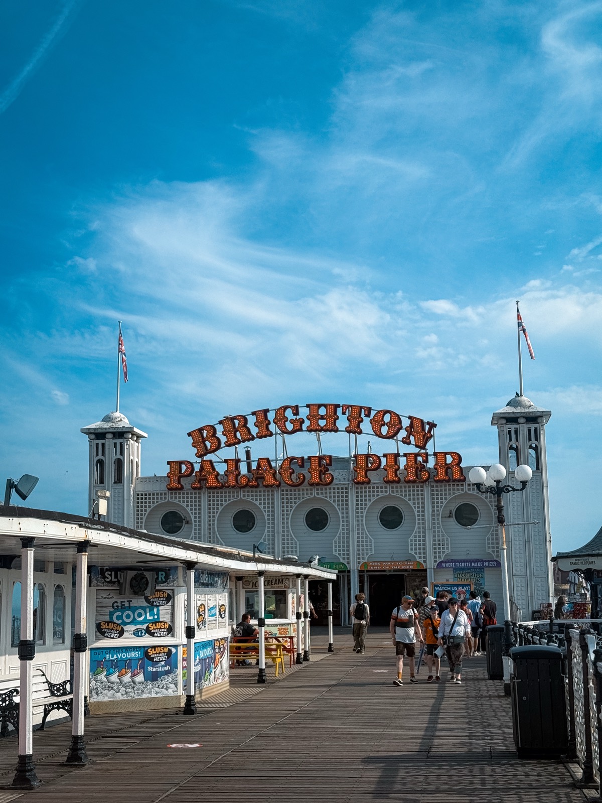
| Palace Pier | Central seafront | Free-to-walk pier with rides and arcades |
| Brighton Marina | East end | Boats, restaurants, cinema and shops |
How Do You Get Along The Seafront?
Three ways trace the same line. You can walk the promenade end to end in under an hour. Volk's Electric Railway runs part of the eastern seafront in season. And the open-top City Sightseeing bus drives the front, stopping at the pier, the i360 and the Marina, so most people walk one direction and ride the other.
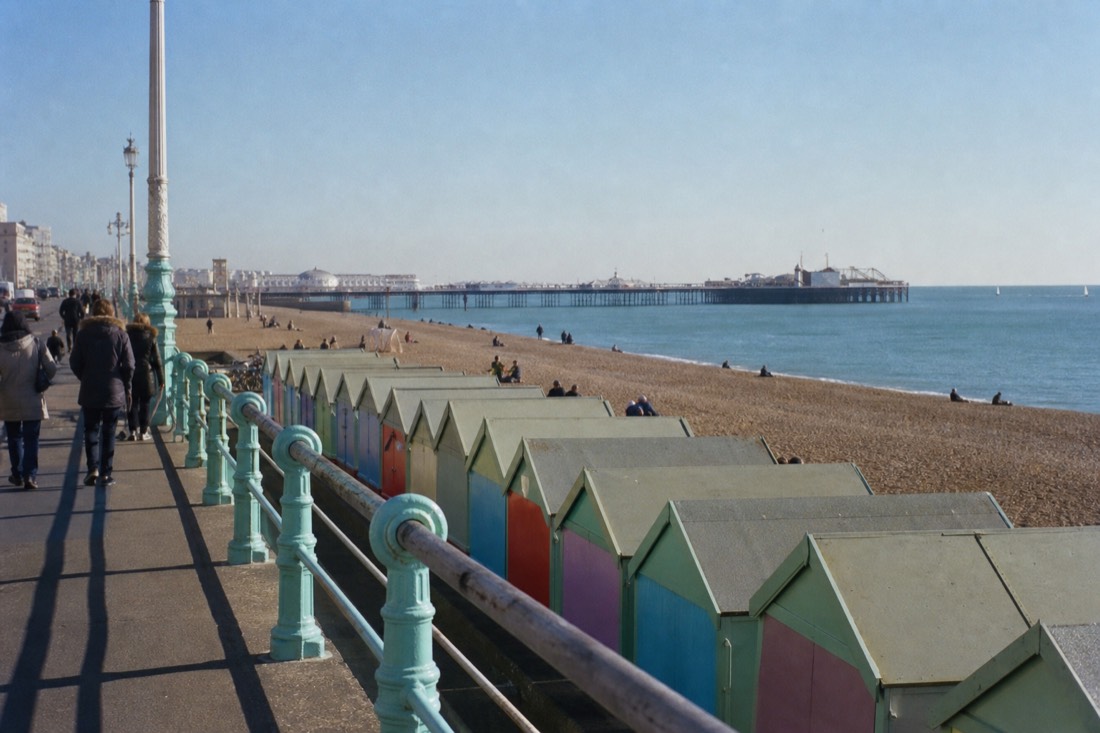
Walking is the honest way to feel the length of it, but the seafront is longer than it looks, and the return leg into a sea wind can sap the fun out of a good day. That is where the wheels help. Volk's Electric Railway, which opened in 1883 and is the oldest operating electric railway in the world, trundles along the eastern beach between roughly the aquarium and the Marina in the warmer months; the Volk's Electric Railway history on Wikipedia covers its long story well. The open-top bus, meanwhile, runs the full seafront as part of its loop, so you can climb aboard at the pier, the West Pier and i360 stop, or the Marina.
If you are seeing several points along the front, the loop links them without the walk back. You can check live availability and prices on Viator or read the detail on the City Sightseeing bus page first.
Where Does The Seafront Start And End?
The walkable central seafront runs roughly from the British Airways i360 and the West Pier ruin in the west to Brighton Marina in the east, a stretch of about two miles. The Palace Pier sits near the middle. Volk's railway covers the eastern portion, and the bus route touches both ends, at the i360 (Stop 2) and the Marina (Stop 11).
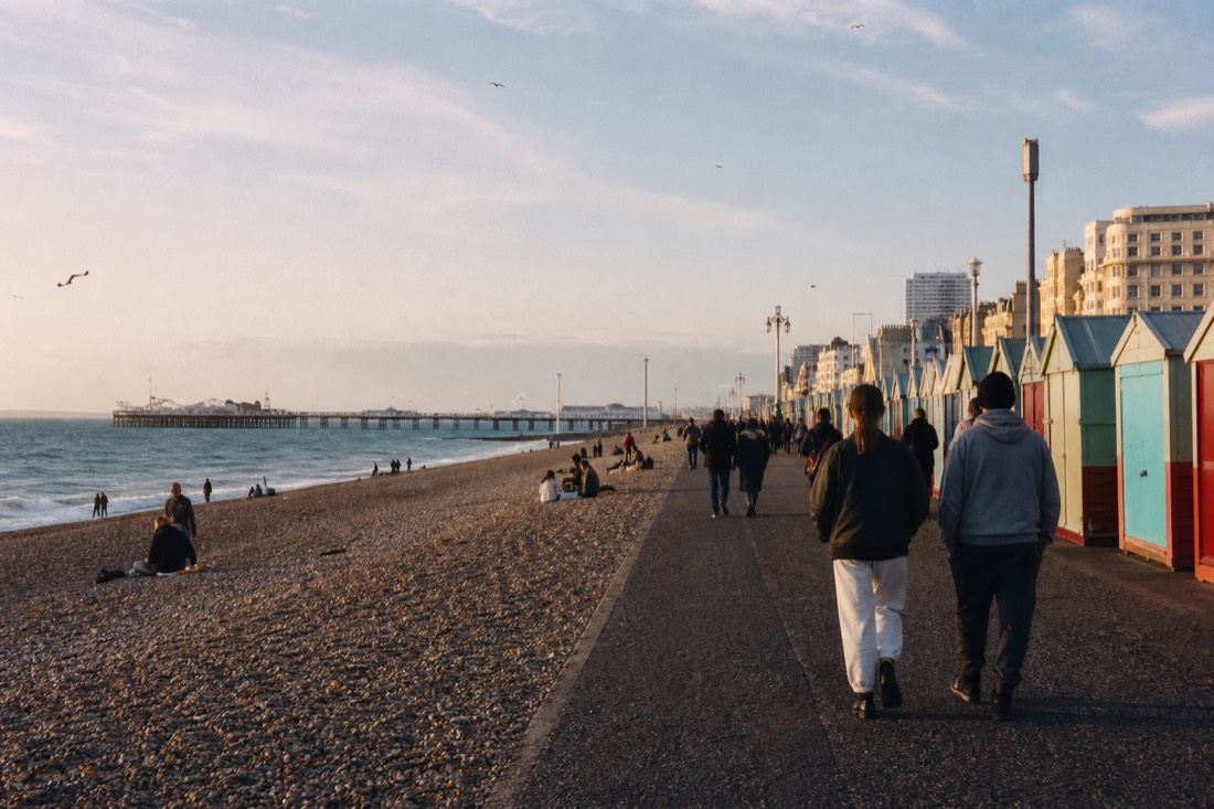
Thinking of the front as a line with the pier in the middle makes planning easy. Head west from the pier and you reach the ruined West Pier, then the i360 tower, then, further along, the calmer Regency seafront of Hove with its beach huts and lawns. Head east and the promenade narrows past the Volk's railway line, the nudist beach, the Marina wall, and finally the Marina itself with its restaurants and boats. The bus route pins both ends, which is why a common plan is to ride out to one extreme, walk back towards the pier, and pick up the loop again.
| Surface | Shingle, or pebbles, along the whole central beach |
|---|---|
| Length | About two miles of walkable seafront |
| West end | i360 tower and the West Pier ruin (bus Stop 2) |
| East end | Brighton Marina (bus Stop 11) |
| Historic railway | Volk's Electric Railway, opened 1883, eastern seafront in season |
| Cost to walk it | Free |
For the landmarks along the way, see the i360 guide, the Volk's Electric Railway guide, the Brighton Marina guide, or the Palace Pier guide.
Common Questions About Brighton Beach And Seafront
Is Brighton beach sandy?
No. Brighton beach is shingle, made of pebbles, along its whole central length. Sand shows only in small patches at very low tide. Bring something to sit on, and water shoes if you plan to swim, since the stones are hard underfoot.
How long is Brighton seafront?
The walkable central seafront runs about two miles, from the i360 and West Pier ruin in the west to Brighton Marina in the east, with the Palace Pier near the middle. Walking it one way takes under an hour at an easy pace.
Does the open-top bus drive along the seafront?
Yes. The City Sightseeing loop runs the front and stops at the pier, the West Pier and i360 (Stop 2), and the Marina (Stop 11). Many visitors walk one direction along the beach and ride the bus back.
What is Volk's Electric Railway?
It is a narrow-gauge electric railway that runs the eastern seafront in the warmer months. Opened in 1883, it is the oldest operating electric railway in the world, and it links roughly the aquarium end of the beach with the Marina.
Is it free to visit Brighton beach?
Yes. The beach and the promenade are free to use and walk. You pay only for extras: deckchair hire, food and drink in the arches, rides on the pier, or a ticket up the i360. The walk itself costs nothing.
Can you swim at Brighton beach?
Yes, swimming is popular in summer and there are lifeguarded zones in season. The water shelves quickly off the shingle, so take care with children, check the flags, and note that water shoes help with the pebbles at the water's edge.
Plan Your Next Step
Have a Brighton date in mind? Check whether the Brighton coastal bike tour fits the guide’s main plan before arranging the rest of the day. If it does not, keep the independent route above.
Choose What Fits Your Visit
- Brighton Coastal Bike Tour: about 2 hours 30 minutes Brighton Unitarian Church, New Road English local guide, bicycle, helmet not wheelchair accessible, maximum 40, food and drink excluded
- Brighton i360: View 360 Ticket: timed pod flight; allow about 25 minutes for the flight Brighton i360, Lower Kings Road, Brighton seafront self-guided attraction Brighton i360 pod admission, 360-degree views across Brighton, the coast and South Downs timed availability varies by date, security and operator access conditions apply
- SEA LIFE Brighton Admission Ticket: allow about 2 hours; ticket conditions vary by date main entrance, Marine Parade, Brighton BN2 1TB self-guided attraction SEA LIFE Brighton admission quieter periods are generally opening and late afternoon; verify timed entry
Scheduled dates from Viator load automatically. Availability and final price are confirmed on Viator.